Randonnée Marche La Cadière-et-Cambo - CAMBO - 10.3Km - 03h10 - Dénivelé 301 m - Photo

CAMBO - 10.3Km - 03h10 - Dénivelé 301 m

 dansmabulle
dansmabulle

Utilisateur

© OpenStreetMap contributors
Longueur
Longueur
10,3 km
Altitude max
Altitude max
609 m
Dénivelé positif
Dénivelé positif
307 m
Km-Effort
Km-Effort  
14,4 km
Altitude min
Altitude min
306 m
Dénivelé négatif
Dénivelé négatif
312 m
Boucle
Boucle
Oui
Date de création :
2014-12-10 00:00:00.0
Dernière modification :
2014-12-10 00:00:00.0

(0 Avis)

Marche
Marche
3h18
Difficulté : Moyen

Scannez ce code QR pour ouvrir la randonnée dans l'application SityTrail

Application GPS de randonnée GRATUITE

Logo SityTrail SityTrail

IGN / Instituts géographiques

Télécharger SityTrail sur l'App Store Télécharger SityTrail sur Google Play

Logo SityTrail SityTrail World

Le monde est à vous

Télécharger SityTrail sur l'App Store Télécharger SityTrail sur Google Play Télécharger SityTrail sur Huawei AppGallery

À propos

Randonnée Marche de 10,3 km à découvrir à Occitanie, Gard, La Cadière-et-Cambo. Cette randonnée est proposée par dansmabulle.

Description

CAMBO
10.3Km - 03h10
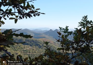
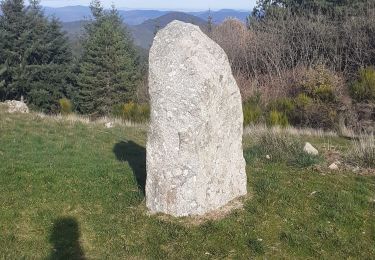
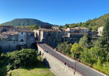
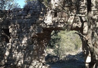
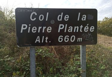
Départ randonnée : Partir du grand terre plein qui se situe à 1 Km de l’intersection de Cambo Cezas en direction Cambo (Gard 30) Balade facile, très beau paysage et très beau village par très beau temps l’on aperçoit la mer.Bonne randonnée 

Profil altimétrique

Localisation

Pays :
France
Région :
Occitanie
Département/Province :
Gard
Commune :
La Cadière-et-Cambo
Localité :
Unknown
Départ:(Dec)
Départ:(UTM)
564967 ; 4868772 (31T) N.

Randonnées à proximité

Randonnée Marche La Cadière-et-Cambo - CAMBO - MONTAGNE DE LA FAGE - 7.6Km - 02h20 - Dénivelé 285 m - Photo
Marche
dansmabulle

Marche

Moyen
(1)
La Cadière-et-Cambo, Occitanie, Gard, France
7,6 km | 11,2 km-effort
2h 29min
Oui
Randonnée Marche Sumène - 30 les crêtes des cagnasses,a la fage 15/11/23 - Photo
Marche
silvestreclaudine

Marche

Très difficile
Sumène, Occitanie, Gard, France
17 km | 26 km-effort
5h 13min
Oui
Randonnée Marche Saint-Roman-de-Codières - st roman de codieres - Photo
Marche
toinou30

Marche

Moyen
Saint-Roman-de-Codières, Occitanie, Gard, France
16,2 km | 24 km-effort
6h 11min
Oui
Randonnée Vélo de route Saint-Hippolyte-du-Fort - St hippolyte Sumène  - Photo
Vélo de route
GUIDE
Roger Philippe Wallez

Vélo de route

Très difficile
Saint-Hippolyte-du-Fort, Occitanie, Gard, France
46 km | 54 km-effort
3h 18min
Oui
Randonnée Marche Saint-Hippolyte-du-Fort - 30  Roquefourcade 16-03_23 - Photo
Marche
silvestreclaudine

Marche

Très difficile
Saint-Hippolyte-du-Fort, Occitanie, Gard, France
17,1 km | 24 km-effort
6h 37min
Oui
Randonnée Marche Saint-Roman-de-Codières - St Roman de Codiere 2 - Photo
Marche
guyzinz

Marche

Moyen
Saint-Roman-de-Codières, Occitanie, Gard, France
13,7 km | 20 km-effort
4h 36min
Oui
Randonnée Marche Sumène - Cézas Prieuré St Martin - Photo
Marche
LBarel

Marche

Moyen
Sumène, Occitanie, Gard, France
6,2 km | 9,5 km-effort
2h 25min
Oui
Randonnée Marche Saint-Roman-de-Codières - St Roman de Codiere - Photo
Marche
guyzinz

Marche

Moyen
(1)
Saint-Roman-de-Codières, Occitanie, Gard, France
14,1 km | 21 km-effort
4h 15min
Oui
Randonnée Marche Montoulieu - Mont Haut  - Photo
Marche
Galoche

Marche

Difficile
Montoulieu, Occitanie, Hérault, France
12,9 km | 18,6 km-effort
4h 50min
Oui


Fermer
Mes abonnements